The History
Radford Army Ammunition Plant History
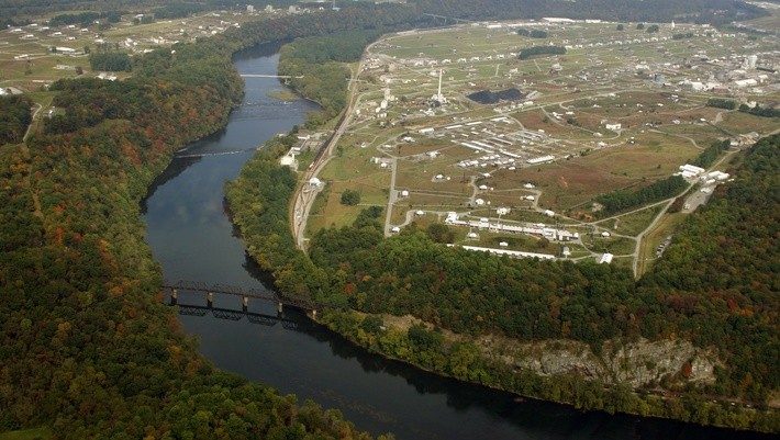
The Radford Army Ammunition Plant (commonly known as “the Arsenal”) has been a keystone in the New River Valley of Virginia since 1941. The arsenal is a major employer in the New River Valley with 2,500 employees.
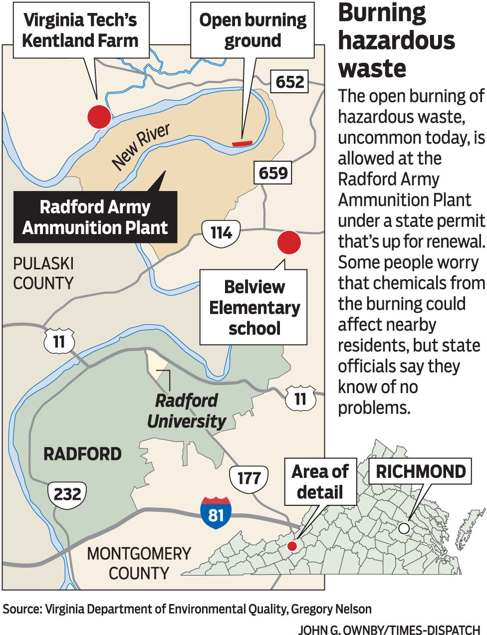
The arsenal is situated in a curve of the New River, straddling both Pulaski and Montgomery Counties. The Radford facility includes 1,200 active buildings on over 4,000 acres.
Below is a map showing the location of Radford Army Ammunition Plant and its open burning ground situated along the New River. Kentland Farm is on its top left, also along the New River. Belview Elementary School does not directly border the RAAP but it is to its bottom right. Pulaski County is to the RAAP’s bottom left. The bottom of the map shows Radford, with Radford University also labeled. A smaller map of Virginia, sectioned into its counties, is included, with the RAAP symbolized by a red dot, and Richmond labeled with a white dot. [Map created by John G. Ownby based on sources Virginia Department of Environmental Quality and Gregory Nelson; from Richmond Times-Dispatch 2015]